Business
NHAI Launches Online Land Acquisition Database to Enhance Transparency

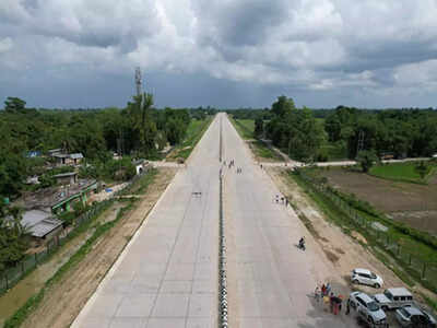
The National Highways Authority of India (NHAI) has initiated a significant step towards enhancing transparency in infrastructure projects by launching an online platform that provides details on land acquisition status and statutory clearances for highway projects. This initiative began on Wednesday and aims to reduce disputes and arbitration related to project execution by making relevant data accessible to bidders.
By updating the dynamic status of conditions required for each project, the NHAI intends to give potential bidders a clearer understanding of project readiness before they submit their bids. A senior NHAI official emphasized that this move will not only pressure the authority to meet its obligations but will also ensure a level playing field for contractors involved in the bidding process.
The online data includes critical information such as land acquisition details, environmental approvals, and necessary clearances from forest, wildlife, railway, and waterway authorities. These elements are essential for the successful execution of each project. A report from the road transport ministry during the last Parliament session highlighted that 489 National Highway projects, originally scheduled for completion by March 2025, are currently behind schedule due to delays in obtaining these necessary approvals.
Delays in land acquisition and statutory clearances can lead to significant time and cost overruns, as well as disputes among stakeholders. The NHAI official remarked that ensuring all conditions are met prior to the start of construction is key to minimizing these issues. When all prerequisites are fulfilled, any defaults by contractors can be addressed more straightforwardly, eliminating the potential for counter charges.
In addition to this transparency initiative, the NHAI announced the deployment of network survey vehicles (NSVs) across 23 states, covering a total of 20,933 km of national highways. These vehicles will collect detailed road inventory data and assess pavement conditions, identifying surface cracking, potholes, and patches requiring maintenance.
The advanced 3D laser-based NSV system utilizes high-resolution 360-degree cameras, differential GPS, inertial measurement units, and distance-measuring indicators to automatically detect and report road defects without human intervention. This technology is expected to facilitate timely corrective maintenance, ultimately improving the quality and safety of the highway network.
Through these efforts, the NHAI is making strides toward ensuring that infrastructure development in India is more transparent and efficient, paving the way for smoother project execution and reduced disputes among stakeholders.
-

 World3 months ago
SBI Announces QIP Floor Price at ₹811.05 Per Share
-

 Lifestyle3 months ago
Cept Unveils ₹3.1 Crore Urban Mobility Plan for Sustainable Growth
-

 Science3 months ago
New Blood Group Discovered in South Indian Woman at Rotary Centre
-

 Sports3 months ago
Broad Advocates for Bowling Change Ahead of Final Test Against India
-

 World3 months ago
Torrential Rains Cause Flash Flooding in New York and New Jersey
-

 Top Stories3 months ago
Konkani Cultural Organisation to Host Pearl Jubilee in Abu Dhabi
-

 Science3 months ago
Nothing Headphone 1 Review: A Bold Contender in Audio Design
-

 Top Stories3 months ago
Air India Crash Investigation Highlights Boeing Fuel Switch Concerns
-

 Sports3 months ago
Cristian Totti Retires at 19: Pressure of Fame Takes Toll
-

 Business3 months ago
Indian Stock Market Rebounds: Sensex and Nifty Rise After Four-Day Decline
-

 Politics3 months ago
Abandoned Doberman Finds New Home After Journey to Prague
-

 Top Stories3 months ago
Patna Bank Manager Abhishek Varun Found Dead in Well


